Aerial Mapping (3D)

Aerial Mapping (3D)

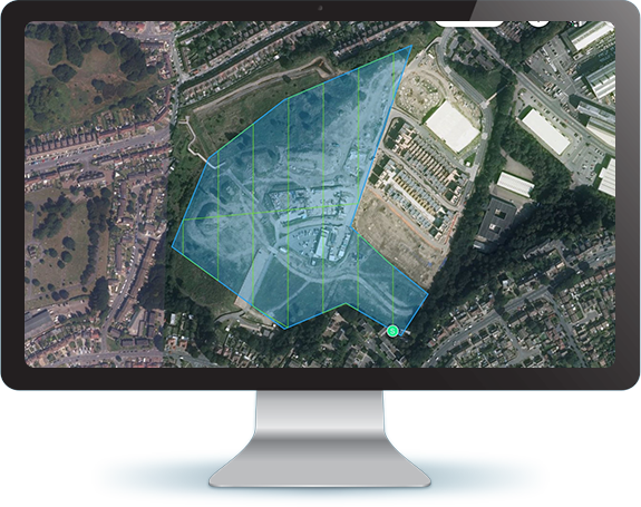
An Aerial photograph, in broad terms, is any photograph taken from the air. Normally, air photos are taken vertically from an aircraft using a highly accurate camera. Aerial photography records the ever-changing natural features on the Earth's surface.

Our services include:

  • Triangulation
  • Block Adjustment
  • Vectorisation
  • DEM (Digital Elevation Mapping) & Contouring
  • Annotation
  • Sheet preparation as per required scale

Work Snippet

We have successfully prepared 3D maps of several international areas like Oman, Orchy, Morar, Sidar, Carlabhagh and Iran. In India, we have prepared 3D maps of Ambala, Bangalore, Chennai, Jammu & Kashmir, Selapass, Nizamabad and many other areas.

Advantages

The basic advantages that an aerial photograph has over a ground-based observation are:

  • Cheaper than conventional surveying.
  • Worldwide coverage is easily available at different scales.
  • Bird’s eye view of large areas, enabling us to see features of the earth surface in their spatial context.
  • It records the surface features at an instance of exposure.
  • The sensitivity of the Digital Camera used in taking aerial photography is relatively more than the sensitivity of naked eyes.
  • Aerial photographs are normally taken with uniform exposure interval that enables obtaining stereo pair of photographs. Such a pair of photographs help in getting a three-dimensional view of the photographed surface.
  • Geo-referencing (in case of 2D)/Triangulation (in case of 3D) of image pairs are created using input data - Images, Control points & Camera file. Bird’s eye view in different Photogrammetry software is obtained using these image pairs. Project specifications are designed, and mapping is carried out and periodical Quality Checks are performed. Model wise data checking for topological and structural errors is performed to ensure quality data as per the project specification.

Some advantages of an aerial photograph over a map are as follows:

  • It provides a current pictorial view of the ground that no map can equal.
  • It is more readily obtained. The photograph may be in the hands of the user within a few hours after it is taken; a map may take months to prepare.
  • It provides a permanent and objective record of the day-to-day changes with the area.
  • It may be made for places that are inaccessible.

Challenges:

  • It is costly and requires more training to interpret as compared to a map.
  • It lacks marginal data.
  • Ground features are difficult to identify or interpret without symbols.
  • The scale of aerial photography is not uniform.
  • It has many distortions such as relief displacement and vertical exaggeration. Hence, distances, directions, and areas cannot be measured directly from aerial photographs without removing this distortion.

Case Study: 3D Aerial Mapping for National Remote Sensing Centre, Indian Space Research Organization (ISRO), Marvel Geospatial & Navayuga Technologies

International

  • Oman (204 sq. km)
  • Orchy (1138 sq. km)
  • Darien (16 sq. km)
  • Costarica (11.6 sq. km)
  • Sunnyvale Plan (83 sq. km)
  • Mountain View (405 sq. km)
  • Iraq (1,342 sq. km)

National

  • Jammu and Kashmir (Indian Railway Construction Company Limited, IRCON) (16.7 sq. km)
  • Selapass (104 sq. km)
  • Bangalore (40 sq. km)
  • Coastal Digital Terrain Model (DTM) (Odisha, Andhra Pradesh, Tamil Nadu, Kerala & some parts of Maharashtra (20 sq. km. buffer from the sea, 63,000 sq. km)
  • Ken Betwa (7,000 sq. km)
  • Banswada (50 sq. km)
  • Nizamabad (500 sq. km)
  • Vishnugad & Tapovan (63 sq. km)
  • Kolkata (29 sq. km)
  • Ambala (50 sq. km)
  • Chennai (190 sq. km)