AMRUT (Atal Mission for Rejuvenation and Urban Transformation) is one of the most prestigious projects of Govt. of India. The objective of the project is to establish infrastructure that could ensure adequate robust sewage networks water supply. Providing basic services (e.g., water supply, sewerage, urban transport) to households and build amenities in cities which will improve the quality of life especially the poor and the disadvantaged is a national priority. Enfragy has successfully completed Geospatial Database creation, ground truthing work and field data incorporation for 25 AMRUT cities covering 7,640 sq. km.
Read More
Our recently completed projects for INCOIS (Indian National Centre for Ocean Information Services) and NHP (National Hydrology Project) will be extremely helpful to our Nation to detect Tsunami and provide Flood alert. The virtual data created by Geotiff will help to identify the direct impact on environment. The rise in river/sea level can be measured and an advance alert can be sent to low land areas.
Read More
Enfragy is proud to serve the Nation by providing our GIS solutions to selective departments of Defence Ministry.
Read More
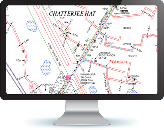
Utility Survey or Underground Survey is used to check the existing underground wiring or lay new lines for water, power, fibre optics, drainage, sewage, gas and telecommunications. The procedure is practiced ensuring that none of the underground assets are interfered with or damaged during the laying work. This vital service lessens the construction risk for the utility owners. This ultimately reduces cost as it helps minimise project delay and damage to other assets.
We use Electronic Pipe Locator (EPL) and Ground Penetrating Radar (GPR). GPR is used to send radio signals into the ground, which creates an image of the pipes and cables, which are below the earth surface. EPL is used to trace out cast iron pipes or any metallic pipes. It can also be used by utilities that have trace wires and inactive power and communication lines. A transducer or antenna is moved along the ground by an operator whilst GPR transmits radio pulses. Underground buried materials, such as pipelines or wiring, bounce the pulses back, which are then stored in the GPR’s control unit. Ultimately, these signals display as different bands, which aid in complete underground assessment. This is a cost-effective and hassle-free method of seeing what’s underground without any drilling or digging.
Read More