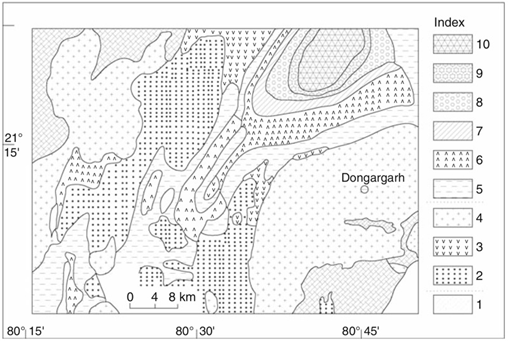
Georeferencing is the process of taking a digital image, which could be an air photo, a scanned geologic map or a picture of a topographic map, and adding geographic information to it so that Geographical Information System (GIS) or mapping software can ‘place’ the image as per the real-world x and y coordinates.
Georeferencing is the act of assigning accurate location to the spatial information. There is no requirement to carry survey and levelling if correct geographical co-ordinates are available. Georeferencing ensures coordinates with reference to ground and extent of data can be verified in the field.

Inaccurate co-ordinates can lead to wrong locational information, positional error and mismatch of features with reference to earth surface.

Scope of Work:
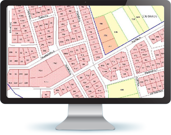
The work involved scanning of raster maps, georeferencing, mapping and assigning patterns of symbols to different mines. The hardcopy maps were converted to softcopy format by scanning and georeferencing the raster maps with respect to their geographical co-ordinates. The areas covered were mining belts of Bihar & Odisha.