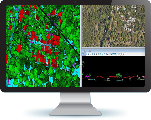
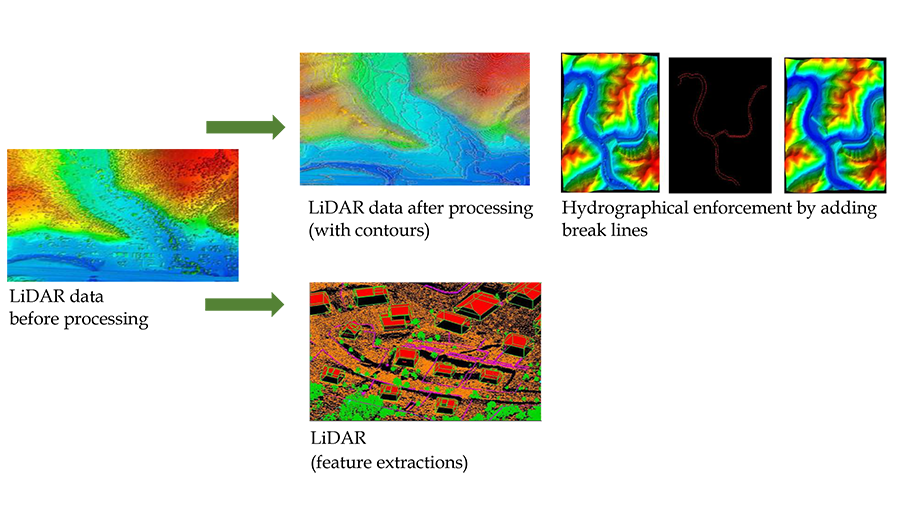
LiDAR is an acronym for “light detection and ranging.” This term is used to describe an airborne laser profiling system that produces location and elevation data to define the surface of the earth and the heights of above-ground features. Mounted on either a helicopter or a fixed-wing aircraft, LiDAR systems use the near-infrared portion of the electro-magnetic light spectrum to collect data during night or day, in canopy, and beneath clouds. Using semi-automated technique, the “raw” LiDAR data is processed to generate several useful end products.
Above all, LiDAR technology offers incredibly accurate, consistent results. The short wavelength can even detect small objects and create exact 3D models, making it possible to determine what the objects are, whether it’s a tree, pylon, water body, or wall.
It operates in ultraviolet, visible region or near infrared. This helps to image the matter which is of the same size or larger than the wavelength. So, LiDAR can detect pollutant particles of carbon dioxide, Sulphur dioxide, and methane. This information helps researchers to create pollutant density map of the area.
It also plays an important role for the archaeologists to understand the surface. LiDAR can detect micro-topography that is hidden by vegetation which helps archaeologists to understand the surface. Ground-based LiDAR technology can be used to capture the structure of the building. This digital information can be used for 3D mapping on the ground which can be used to create models of the structure. It is very useful for maintaining a record of the structure.
LiDAR technology can be converted to create slope and sunlight exposure area map which help in agriculture. The areas require more water or fertilizer can be detected and it becomes useful for the farmers to save on their cost of labour, time, and money. The same approach can be used to monitor the impact of human activity on forest areas with 3D models. This remote sensing method has an edge over other tech in the fact that it can penetrate tree cover while retaining mapping accuracy.
Periodic maintenance of power lines come with massive safety hazards. These risks can be eliminated by using LiDAR sensors to recognize issues in power lines before they turn into significant problems.
LiDAR is great for generating data on the volume of mineable material in an open mine without disrupting operations on-site. This increases productivity and reduces cost and time overheads.
Enfragy has more than 12 years of work experience on LiDAR data. We have successfully processed more than 6,900 sq. km of LiDAR data covering more than 14 cities.